

A Love Letter from the Sunrise Trail
A meandering journey along the Northumberland Strait.


Hayley and I had spent the last 30 hours and ~1,950 miles snaking east from Saint Peter, Minnesota on U.S. Interstates and the Trans-Canada Highway. We were on the homestretch, or Hayley was anyway, and it was time for a change of scenery.
We said goodbye to the four-lane at Amherst and picked up Nova Scotia Trunk Highway 6, which angles northeast from the Bay of Fundy’s marshy shores towards the Northumberland Strait. Nobody really calls the road Highway 6 or Route 6 because it’s also the western half of the Sunrise Trail, a scenic byway that’s simply known as “the Trail” in Pictou County. The route runs along Nova Scotia’s north shore from New Brunswick to the southern tip of Cape Breton, give or take a few kilometers in either direction.
It was June 2019 and it was my first visit to Canada—and to Nova Scotia, Hayley’s childhood home in Pictou, and the family cottage on Pictou Island. Fortunately, I’d already met her parents. A lot of new things were happening all at once, a feeling I’m familiar with in 2025 as I go through the immigration process and prepare for my upcoming move to our home in Canada.
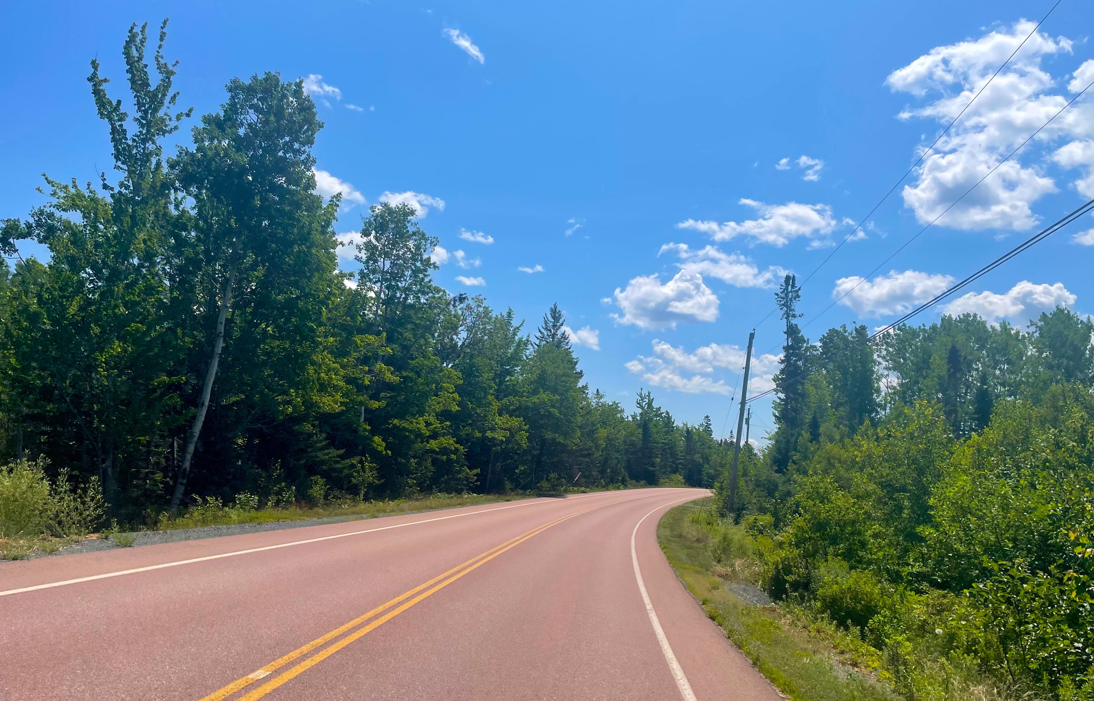
Our Jeep bounced down patchwork blacktop past farmsteads and thick forests, rolling meadows and forgotten country cemeteries. The landscape was brilliantly green despite the heavy fog. I immediately understood why the crofters who were chased out of Scotland by the Highland Clearances felt at home here. We passed a pasture of sheep that paid us no mind, then a weathered stone shed near a crumpled-in farmhouse. The inland miles of the route looked like the cutting-room floor after a postcard photoshoot, pretty enough to capture on film but nothing that anybody’d buy at the drugstore to send home.
We’d been on the Trail for 20 minutes of emerald and mist, and I was convinced the whole province was haunted. The Strait was still out of sight, somewhere off in the distance.
And Nova Scotia is haunted, I guess, by more history and conflict1 than my home state of Minnesota. The Mi’kmaq people, the French and Indian War and the Acadian expulsion (in French: Le Grand Dérangement), the British influence, the Scottish immigrants, the perfect transcontinental location that made it a center of trade and industry until after World War II, the tough economic times that followed—all of these ingredients and more combine to form the sociocultural bouillabaisse (or chowder, these days) of Nova Scotia.
And people forget that the province is part of the Appalachian Mountains, which used to be in the same range as the Scottish Highlands if you look back far enough. The land creaks with memory.
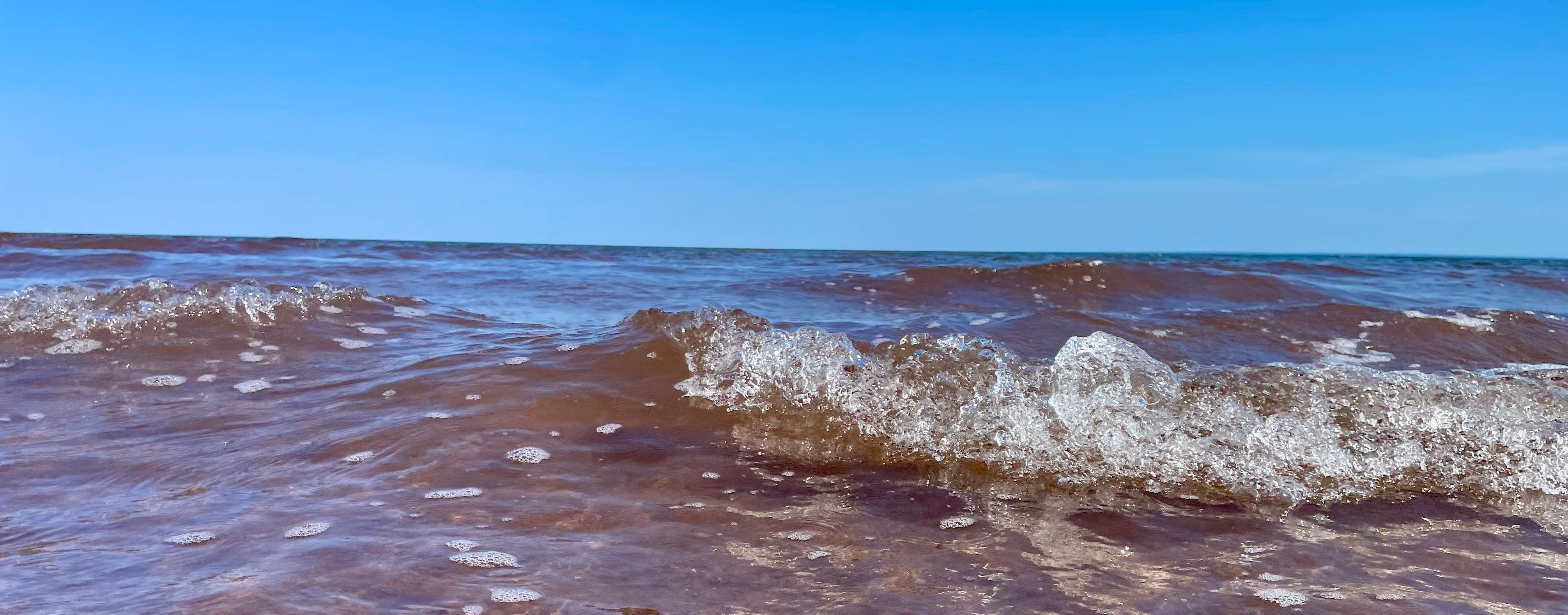
I saw the waters of the Northumberland Strait for the first time when we crested the hill at Port Howe, where River Philip meets the ocean. The fog had been replaced with covering clouds that the sun couldn’t quite overcome. The next day, I’d be plucking lobster and baiting traps on my father-in-law’s boat for the first time. Just over a month later, Hayley and I would be married.
We passed through Pugwash, pop. 746, famous for an enormous salt mine, fine pewter artisans, and hosting the first-ever Pugwash Conference on Science and World Affairs, an international anti-nuclear weapons conference that was awarded the Nobel Peace Prize in 1995 alongside Joseph Rotblat.2 Today, the village website features tourism materials promising “It’s a shore thing” along with links to weather forecasts and tide charts—important resources for those who live, work, and recreate on the Northumberland shore.
We drove through Wallace, past Malagash, and into Tatamagouche (home of the hand-dipped Appleton Chocolates we served at our wedding and continue to ferry back to Minnesota). The clouds were breaking up ever so slightly as we crossed into Pictou County near the community of River John, which hosts the annual Read by the Sea literary festival that has attracted such authors as Margaret Atwood and Alistair MacLeod.
Hayley told me we were getting closer to Pictou. I didn’t know whether to hurry up or slow down. We rolled onto the stretch of the Trail that has grown to be my favorite, from Melville to Toney River.
The Sunrise Trail is close to the ocean here. Contented cows graze in the salty air atop pastures that roll down to the water. Far from the bustle of Nova Scotia’s tourist-packed South Shore, the Trail is dotted with quiet vacation cottages, proud country churches, and homes of the harvesters who reap by land and sea.
The road winds to the southeast soon after passing the Toney River wharf, which boasts a lighted two-story lobster-trap Christmas tree every December. Before I knew it, we were into the woods of Caribou River as we approached the town of Pictou.
Maybe it’s longing rather than memory, but I like to think the sun broke through the clouds as we arrived.
When I came down this Trail for the first time six years ago, I had no idea that I’d one day be moving here. I’m leaving a well-ordered life and career in Minnesota and, perhaps for the first time in my life, I don’t have a plan. But the pace is a little slower here and at least this month, there’s been time to think.
On Wednesday, Hayley and I took the Sunrise Trail on the way back from Moncton, New Brunswick. We’d been there for a short visit with Hayley’s aunt and uncle and a surgical consultation for our dog.
On the drive home, we talked about what we’d do differently living here, what we thought was important to keep hold of, and how we’ll work together to make it all happen. There’s still no clear plan, and that’s okay for now. We’ll figure it out when I’m back for good in the fall.
After living together in our house in Bayview for the last few weeks, it surprises me how easily the word home rolls off the tongue.
I asked around town this week and nobody could give me a definitive answer for why or how long it’s been called the Sunrise Trail. I had a nice chat with two librarians about it, but even they were stumped.3
But I did learn one other fact that I’ve been wondering about ever since.
The Mi’kmaq in Nova Scotia are part of the Wabanaki Confederacy, a council of Algonquian nations from Eastern Canada and the Northeastern United States whose alliance stretches back to the the 1600s and is active again as of the 1990s.
Wabanaki means “people of the dawn,” or “Dawnland.” Each of the five nations of the confederacy have versions of the word, and related words with similar roots and meanings.
A person might translate one of those Mi’kmaq words to “Sunrise.”
It would be a fitting name for an old East-West trail along the Northumberland Strait.
I think it’s always a good idea to acknowledge the lens you’re looking through. My reference to “history and conflict” here is primarily focused on European history, armed conflict, and migration. You know, the kind of history we’re taught in schools, the relatively modern patterns of human activity and geopolitics that have been documented and passed down in writing since the “discovery” of North America.
Since the inaugural gathering in 1957, The Pugwash Conferences have only returned to Nova Scotia twice, in 1959 and 2003. The Nobel Peace Prize award citation notes that “During the Cold War, the Pugwash movement served as a channel of communication between the communist Eastern block and the Western democracies. Participants played important parts behind the scenes in bringing about nuclear test ban and non-proliferation treaties.” Good things happen when scientists, humanists, researchers, and thinkers from different fields come together to take on the great challenges of our time.
I’ve also reached out to Tourism Nova Scotia. Research about what was originally meant to be an inconsequential detail of this piece may ultimately continue in River John, where I’ve been given the name of two local historians.
This captures perfectly the reason we all drive the trail, especially when coming home after being away. It's magic.
You are a remarkable storyteller, JJ. I feel like I actually made the drive myself! Looking forward to following your adventures.